

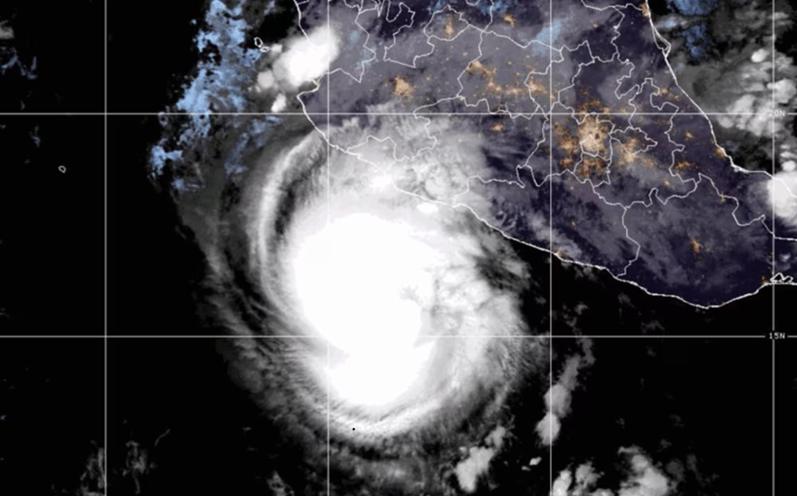

Hurricane Trudy is moving toward Mexico’s Pacific coast and is expected to pass close to the shoreline of Colima and Jalisco states late Saturday into Sunday, October 17–18, 2026. The US National Hurricane Center (NHC) put its maximum sustained winds at 90 mph (150 km/h) early Saturday, and the storm could strengthen a little more before it starts to weaken.
The bigger threat is water, not wind. The NHC warns of life-threatening flooding and landslides in mountainous areas that have already been soaked by earlier storms this month. Below is where Trudy is now, why it matters, what the forecast says and what people on the coast should do.
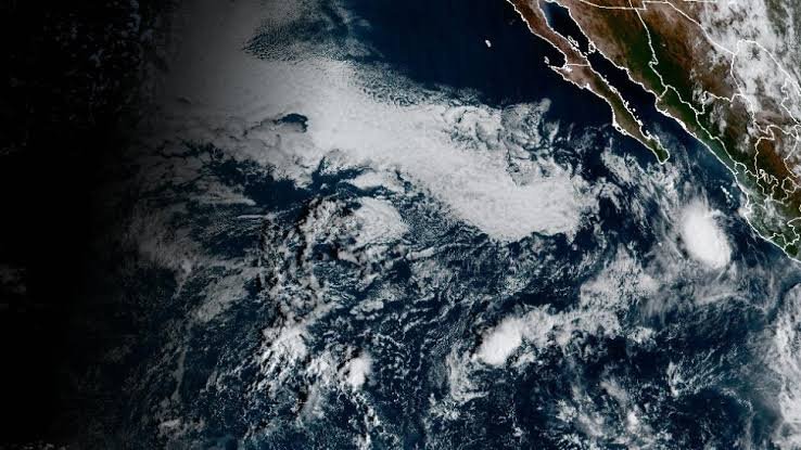
Hurricane Trudy Today: What Happened and Where the Storm Is
At the 6:00 a.m. CST advisory shown on the Zoom Earth Hurricane Trudy live tracker, the center was near 16.3°N, 103.7°W, moving northwest at about 8 mph (13 km/h). According to Al Jazeera, citing the NHC, that was about 190 miles (305 km) south-southeast of Manzanillo. The northwest motion is forecast to continue through Sunday, bringing the center close to the coast of southwestern and west-central Mexico.
A hurricane warning is in force from Manzanillo in Colima to Cabo Corrientes in Jalisco. Tropical storm conditions are expected across the region during Saturday, with hurricane conditions likely in the warning area on Saturday night. They are also possible in areas under a hurricane watch. Colima’s state government says current risk is low, but warns that heavy rain could still do damage on saturated ground. The Mexican navy has urged mariners and coastal residents to take extreme caution.
Key readings from the tracker:
- Winds: 90 mph (150 km/h) with higher gusts, Category 1 on the Saffir-Simpson scale
- Size: hurricane-force winds reach up to 35 miles (55 km) from the center, tropical-storm-force winds up to 140 miles (220 km)
- Pressure: estimated at 979 mb
- Motion: northwest at about 8 mph
The compact hurricane-force core means the strongest winds should hit a fairly narrow strip of coast. The rain and surf will be felt over a much wider area.
Why Trudy Became a Threat So Quickly
Trudy grew fast. Zoom Earth’s tracking log shows it was a tropical depression on October 13, reached hurricane strength on October 15 and peaked at 120 mph (Category 3) with a pressure of 956 mb on October 16. By Saturday it had eased back to 90 mph. The sources do not explain the dip, and forecasters say some strengthening is still possible today.
- Lower peak than forecast: On Thursday, the Associated Press reported that the NHC expected Trudy to become a major hurricane on Friday. The latest forecast on Zoom Earth tops out near 105 mph, which is Category 2.
- Higher rain totals: Thursday’s NHC outlook, as reported by Telemundo 51, gave isolated totals of up to 12 inches for Colima and Jalisco. The current NHC figure is 15 inches (38 cm) in places across Michoacan, Colima and Jalisco.
- Slow movement: At about 8 mph, the storm spends longer near any one area, so more rain can fall in the same place.
The wider cause is a very warm ocean. Al Jazeera reports that this year’s eastern and central Pacific season is a record one, fuelled in part by El Niño, which warms parts of the ocean. Warm water works like fuel for a hurricane. The same report says the season’s accumulated cyclone energy, a measure that combines storm strength and lifespan, has passed the previous high set in 2018.
Background: Why Western Mexico Is So Exposed
Mountains rise steeply close to this stretch of coast, so heavy rain runs off quickly into rivers and onto slopes that can give way. That is why the NHC singles out steep terrain for landslide risk. Trudy’s track also runs roughly parallel to the coastline, which keeps several states inside its rain bands at once.
The ground is already wet. Hurricane Simon, a Category 4 at its peak, and former Hurricane Rachel, a Category 3 in early October, both hit the region this month. Al Jazeera reported on October 12 at least two deaths, one in Guerrero and one in Baja California, and about ten people missing in Baja California, according to state officials. Those figures were preliminary.
History adds to the concern. Hurricane Patricia made landfall on the Jalisco coast in October 2015 as a Category 5, one of the most intense Pacific hurricanes ever measured. The eastern Pacific season officially runs until November 30, so the risk has not passed.
Other Affected Areas and Wider Impact
Beyond the warning zone, the NHC expects 4 to 8 inches (10 to 20 cm) of rain across parts of Michoacan, Colima and Jalisco through the weekend. Outer rain bands could bring 2 to 4 inches, with isolated totals near 6 inches (15 cm), to Guerrero and Nayarit, where localized flash flooding is possible.
The coast faces a second hazard from the sea. The NHC warns of storm surge flooding where winds blow onshore, with large and destructive waves. Swells from Trudy are already reaching the southwestern coast and will move north along the west-central coast through the weekend, creating life-threatening surf and rip currents. Tourist areas near the warning zone, including Puerto Vallarta, should watch official updates.
What Comes Next: Hurricane Trudy Path and Forecast
Zoom Earth’s forecast table (times in UTC; Mexico’s Pacific coast is on CST, six hours behind) shows a gradual decline after Sunday:
- Saturday, October 17, 18:00: Category 2, about 105 mph
- Sunday, October 18, 18:00: Category 2, about 100 mph
- Monday, October 19, 06:00: Category 1, about 80 mph
- Monday, October 19, 18:00: tropical storm, about 65 mph
- Wednesday, October 21, 06:00: remnant system, about 35 mph
The exact landfall point and any damage or casualties are not yet known. Intensity forecasts have already shifted once, so check the latest advisories rather than relying on one number.
What Residents and Travelers Should Do
- Follow local civil protection (Protección Civil) instructions and the advisories from the National Hurricane Center and Mexico’s national weather service.
- Stay off beaches and out of the water. Rip currents can form far from the storm’s center.
- Do not cross flooded roads or swollen rivers, and stay away from steep slopes and the base of hillsides.
- Charge phones and power banks, and keep water, food, medicine and documents ready.
- Travelers should check with airlines and hotels before moving. In an emergency in Mexico, call 911.
The Bigger Picture
Trudy shows why a hurricane’s category number is only part of the story. Its winds have dropped from their Friday peak, yet the rain forecast has risen, and the ground in western Mexico was already saturated after Simon and Rachel. In a record Pacific season shaped partly by El Niño, the real strain comes from storms arriving one after another, wearing down slopes, rivers and emergency services before the next one lands.
This is a developing story and will be updated.